
USAID BGI Trail Maps
Spark was approached by USAID Business Growth Initiative in the Kyrgyz Republic to assist in developing new trekking maps for different regions of the country. Kyrgyzstan is a beautiful mountainous country with many great scenic treks, however few of them were marked or documented.
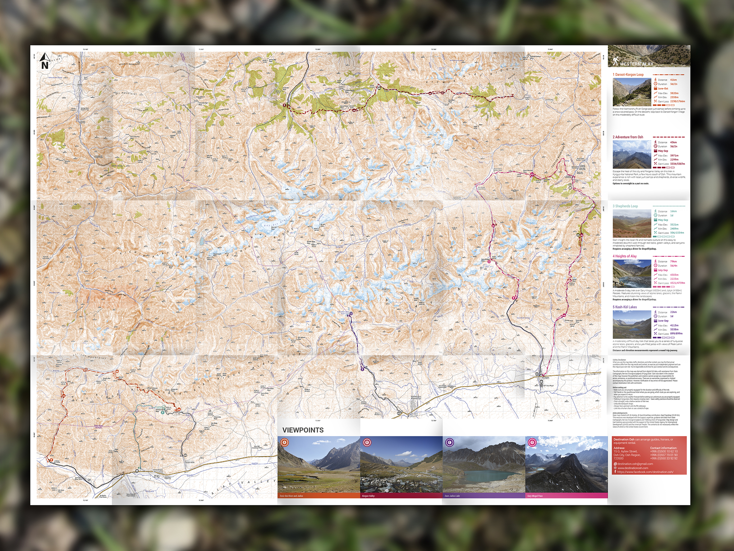
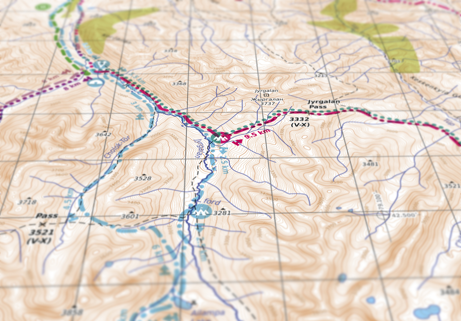
The routes were marked by guides using GPS, and then superimposed onto the maps. These were created by hand using a combination of current electronic data and previous surveys. As well as creating the maps themselves, Spark developed the marking system, icons, and integrated sumptuous photography of viewpoints on each trek to encourage local and international tourists to strike out and explore. Each trek is graded by difficulty with distance, height gain/loss and seasonal availability included in easy-to-read panels.
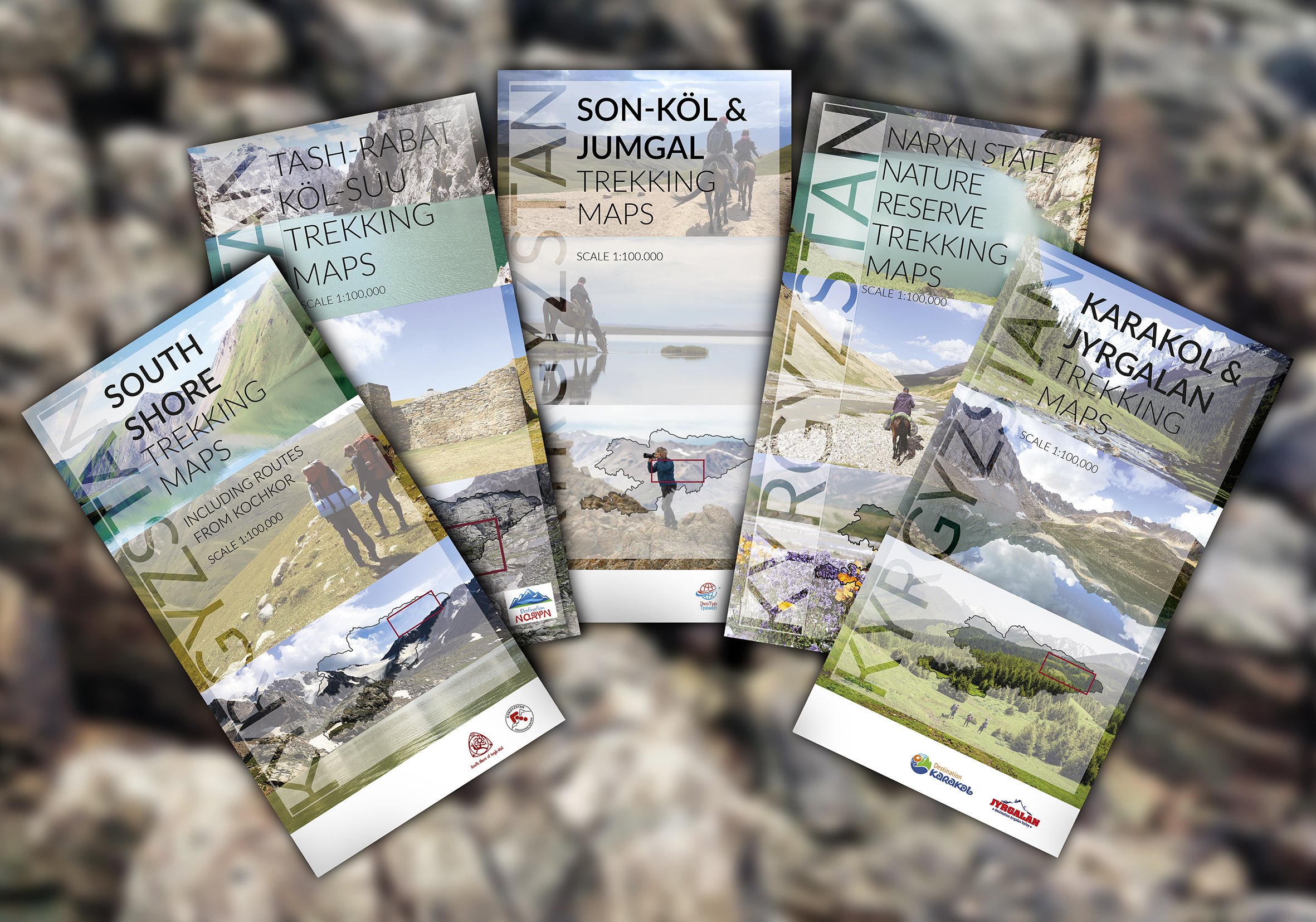
There are currently 8 maps covering four main regions, with over 50 trails marked and rated. The maps are supplemented by large information panels at various trail heads.
We’re proud to have been a part of this project that we trust will enrich everyone’s experience of this amazing country.
Online trek descriptions can be found on regional Destination Management Organizaton (DMO) websites, and paper copies are available for purchase at DMO offices across the country. DMOs can also assist in arranging guide services, gear rental, trek planning, and any other trekking needs. Please visit the DMO websites for more information:
– South Shore of Issyk Kul: www.southshorekg.com
– Karakol: www.destinationkarakol.com
– Jyrgalan: www.destinationjyrgalan.com
– Osh/Alay: www.destiantionosh.com
– Naryn: www.cbt-naryn.com
Maps are also available for purchase at the office of the Trekking Union of Kyrgyzstan (TUK) in Bishkek – www.tuk.kg.